Coast to Kosci 2023
Coast to Kosciuszko is an iconic Australian ultramarathon. Starting at Twofold Bay near Eden the course traverses 240km to arrive at the summit of Mt Kosciuszko, the highest point in Australia. 2023 was my first time taking part in this awesome race, which copped huge amounts of rain and weather.
What an epic adventure, and I am honoured to have joined the cohort of Coast to Kosci finishers. I think I'm still processing what we achieved over those two days, but it really is a special race.
A huge thanks to my support crew - Dad as Crew Chief, Rachel as crew and pacer, and Mike who pulled a huge 12 hour pacing stint to drag me through Jindabyne and up the mountain. Something like this can't be achieved without the crew, and they had to deal with weather, me being tired grumpy and stubborn, mechanical issues and who knows what else. This is truly a team effort and I can't express how grateful I am to the team.
With Eden forecast to have 300mm of rain in the days before the event, flooding cutting off roads and the highway there was the question of if the event would even go ahead. There was a 21km section after Towamba that was flooded and unsafe to pass, but the race directors came up with a solution - We would run out to Towamba as usual, but then turn around and run most of the way back to the start to a new checkpoint 1A. There our race time would pause, and our support crews would bundle us into the car and drive us around the flooded section to New Buildings (about an hour drive). There the race time would resume, and we would continue running along the original course.
Certainly a unique solution, but one that allowed the race to continue rather than having to be cancelled, and remains on the original route and distance - would the hour spent in the car be an advantage or not? Who knows!
The night before the race was more stressful than I would've hoped which is something I really need to work on. Although the weather was completely out of my control, I still had difficulty detaching from the stress and not worrying about it.
We spent the incredibly wet evening preparing things for the next day, transferring gear into the car that was to be used as the support vehicle and then heading over to registration and race pack pickup where we would be getting details on the changes to the course.
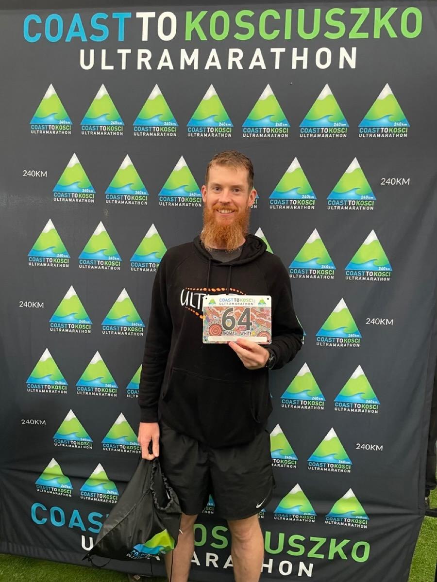
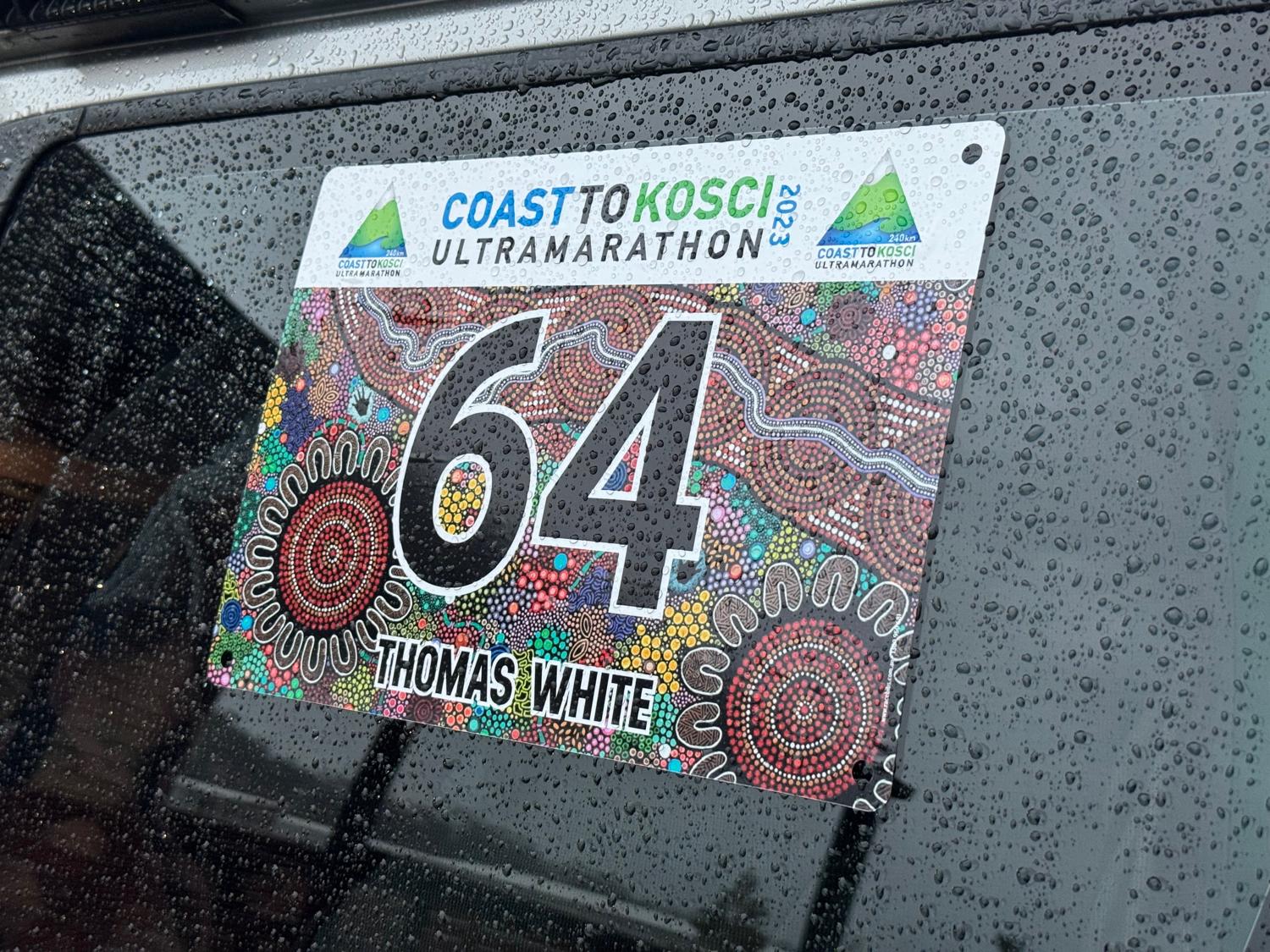
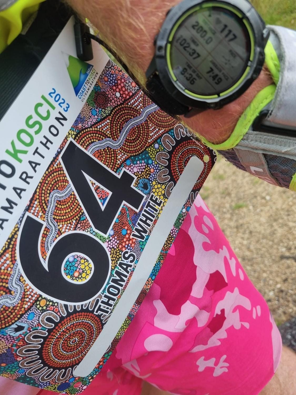
All registered and ready to go!
We wandered over to registration at the Seahorse Inn in the rain, and hung out there for a little while after picking up the registration gear, signage for the support vehicles, and confirmed crew details and picked up the signage for the support vehicles.
Then it was back to the cabin for last minute prep, dinner and sleep.
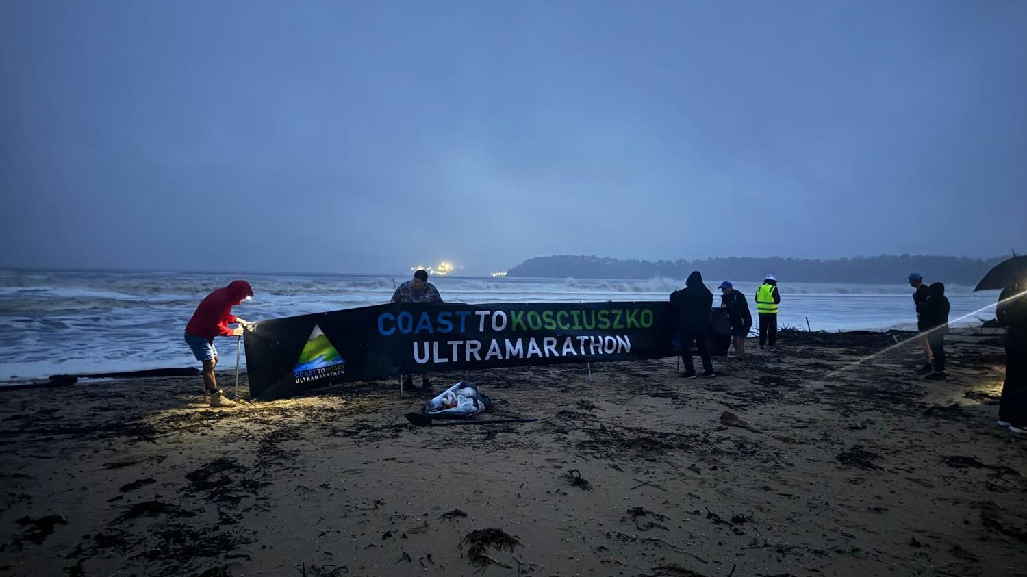
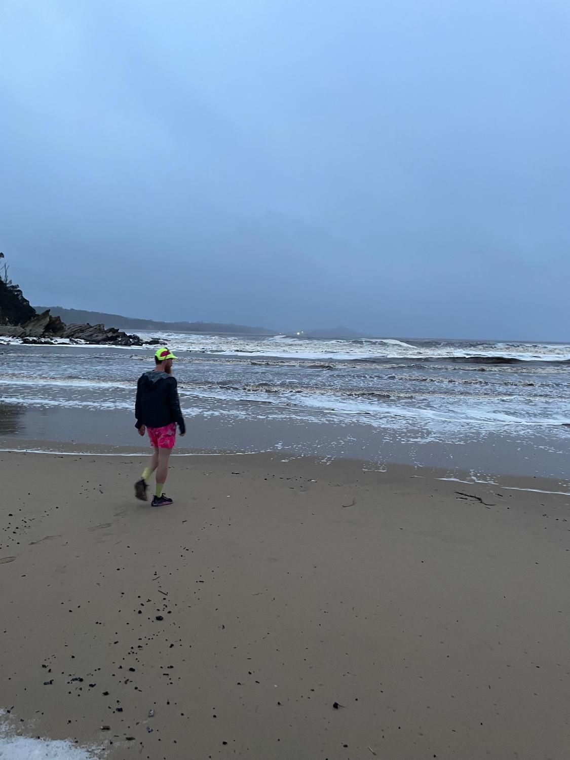
I didn't get a great sleep, and got up at about 3:45AM for breakfast, coffee and to get myself dressed and ready to go. Then we head down to the beach for checkin, a welcome to country ceremony and to await the start.
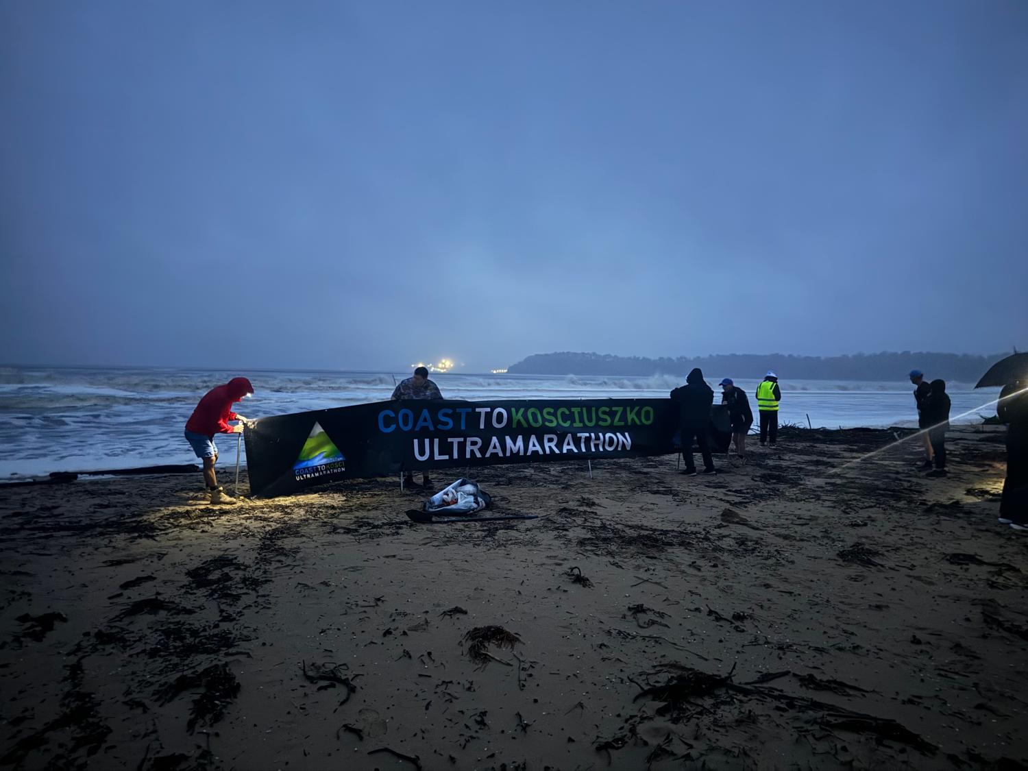
To really ensure that it was a run from the coast, I wandered down to the tumultuous ocean and touched the water - in approximately 230km time, I would be standing at the highest point on the continent.
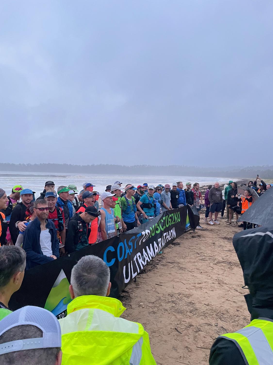
Ready to start!
We lined up behind the banner for a photo, and then in front of the banner and after a brief countdown we were on our way. We head up off the beach, across the Nullica River on a narrow bridge, and onto the steep fire trail into the rain and the awaiting course.
The journey had begun.
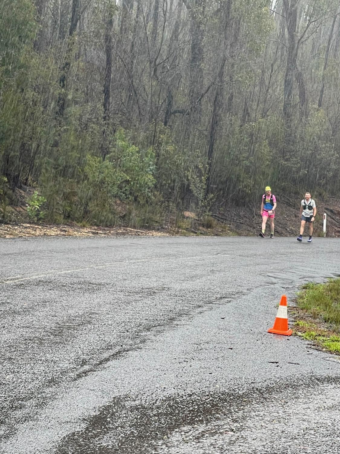
In what would be a continuing trend of weather and obstacles, about 5km into the race we came across a downed tree blocking the road. One of the race officials warned us to be mentally prepared that they might not be able to get the tree cleared and our crews to us by the time we reached Towamba.
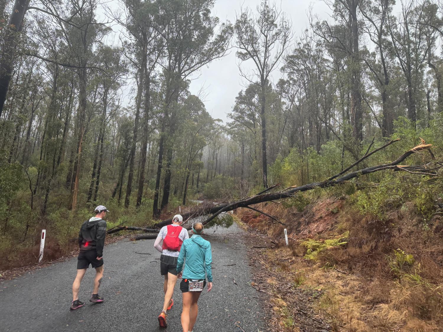
We carried on, climbing and descending undulating terrain; admiring the forests through to Towamba which are really quite pretty in the rain.
By the downhill section into the Towamba valley we could hear cars coming up behind us. This was a big relief that the crews would be coming through! Getting excited by the cars and the cheering from the crews I probably got a little carried away on the downhill...
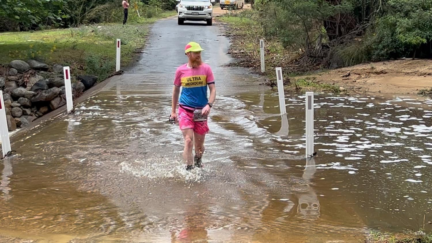
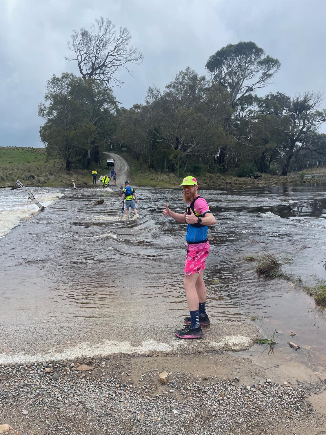
On the way into Towamba was a couple of causeways to get the feet nice and wet just in case the rain wasn't getting things wet enough. It was a pretty easy turnaround - Go in, get supplies for the return leg and then start heading back. The return leg was fairly uneventful, but I spent a good chunk of it running with Matt (who would go on to place third) particularly on the downhill section into Checkpoint 1A .
We came into checkpoint 1A in the pouring rain, had the time recorded and written on our arms and then hopped in the car to head to New Buildings. This drive took about an hour, where I took the opportunity to dry my feet and put dry socks on, and smash a bunch of food.
Getting out of the car at New Buildings things were certainly a little stiff, but I tried to get back into it again knowing that things would loosen up. The next short section through to Checkpoint 2 - Rocky Hall, and to Cow Bail Trail was beautiful countryside along the Towamba River, but reasonably uneventful. I acquainted myself with the nice toilet at Rocky Hall, which was perhaps a sign of things to come...
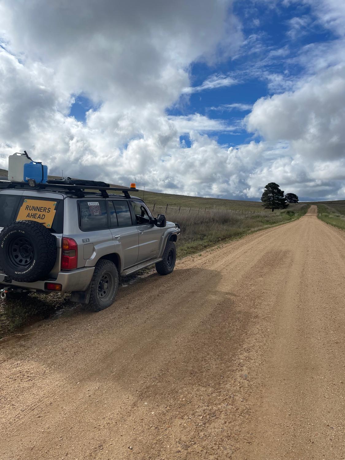
Upon leaving Rocky Hall it's only 4.5km along the river to the start of Cow Bail Trail. The original C2K course continues up Big Jack Mountain Road, however the road is currently closed due to a landslide, so the course deviates up Cow Bail Fire Trail - a reasonably steep climb that actually ends up higher than Big Jack Mountain Road. The support vehicles have to double back and drive to Cathcart via Mt Darragh road, so it's a 15km stretch with no support vehicle that requires a mandatory pacer.
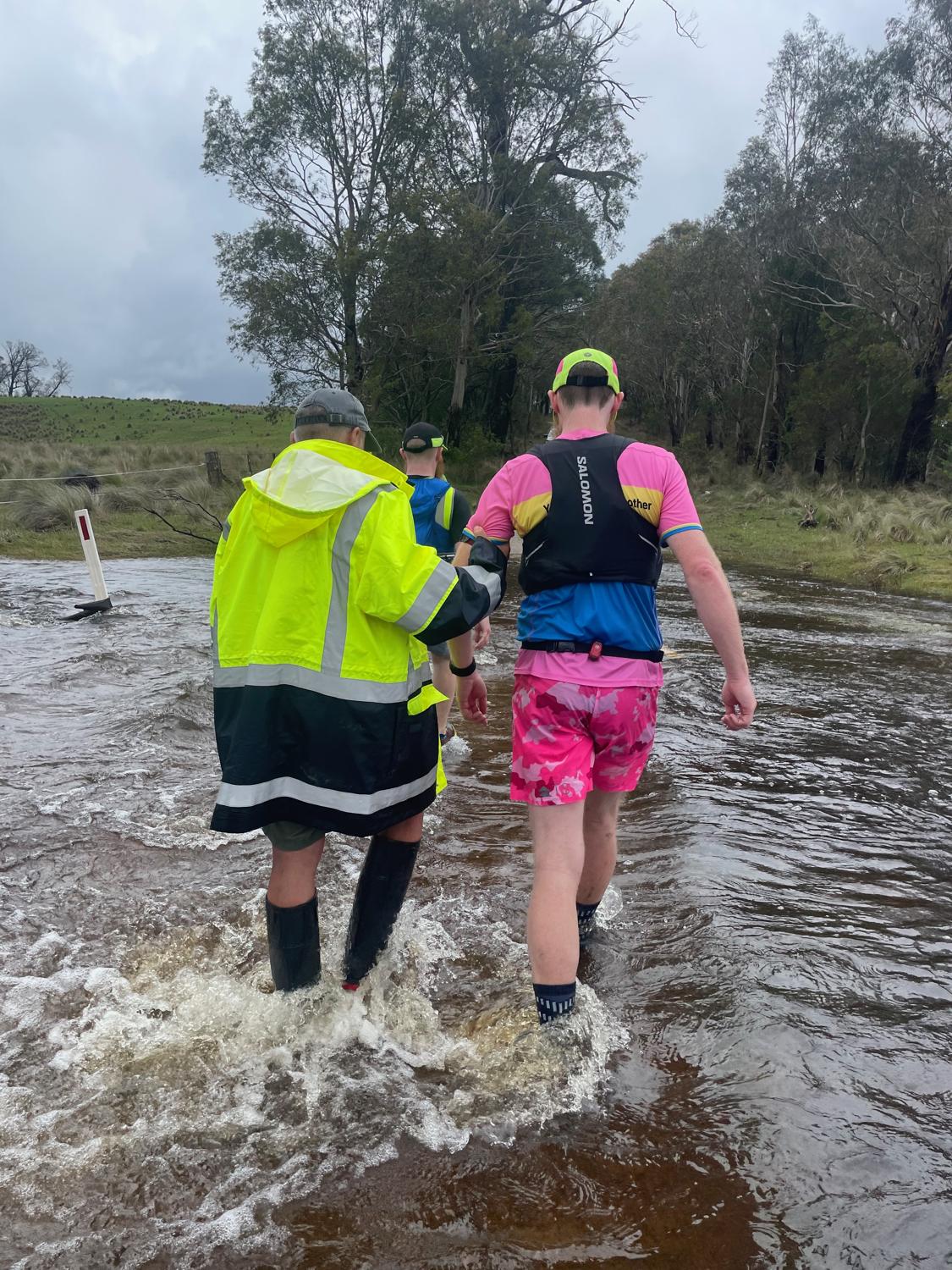
Just before Cow Bail Trail, Mickey finds me and lets me know that there's a flooded causeway up ahead that isn't too deep but is fast flowing (so much for my dry socks - although a women did offer to carry my shoes across which was a nice gesture). Crossing over that, my crew handed me my vest and with Rachel pacing we head off up Cow Bail Trail!
I was looking forward to Cow Bail Trail because it's more like the usual terrain that I do - Steep trails. Unfortunately, I wasn't feeling 100%. The rain had stopped and the sun had come out, making it feel real sticky and humid. Plus, my stomach was playing up and I'm still not entirely sure why - I was using the fuelling strategy that I had trained with just fine.
For some reason I got it in my head that it was all the Tailwind causing issues (although I have no proof for this) which wasn't amazing, since I was planning on using a bunch of tailwind throughout the race.
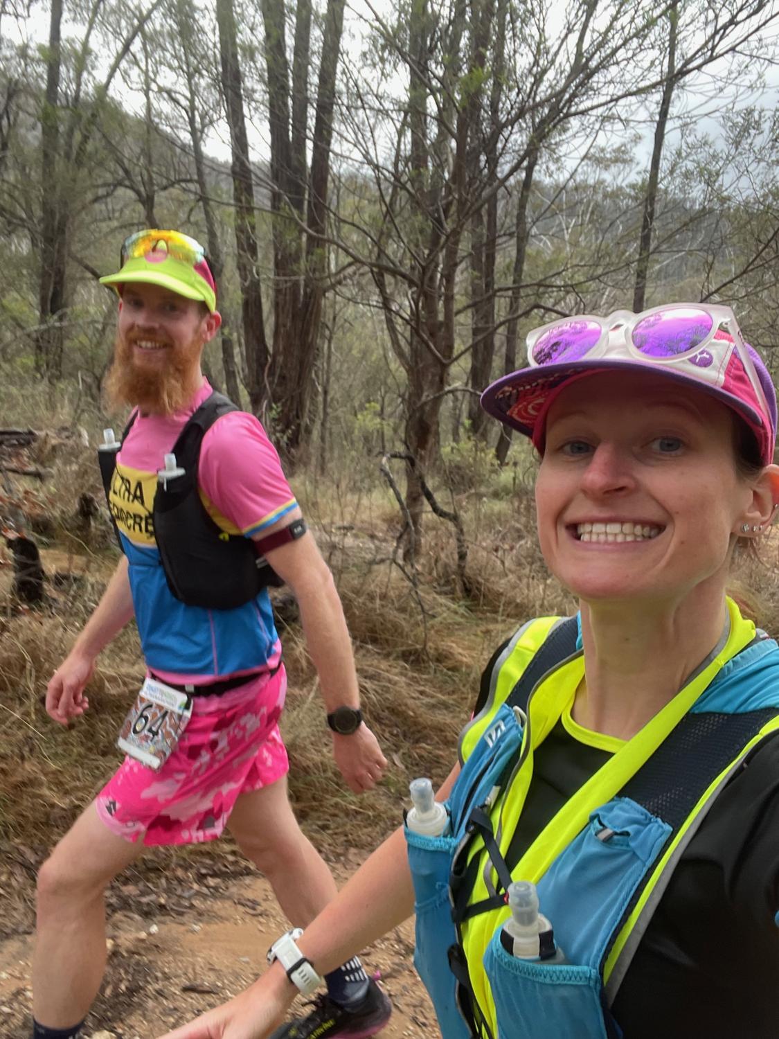
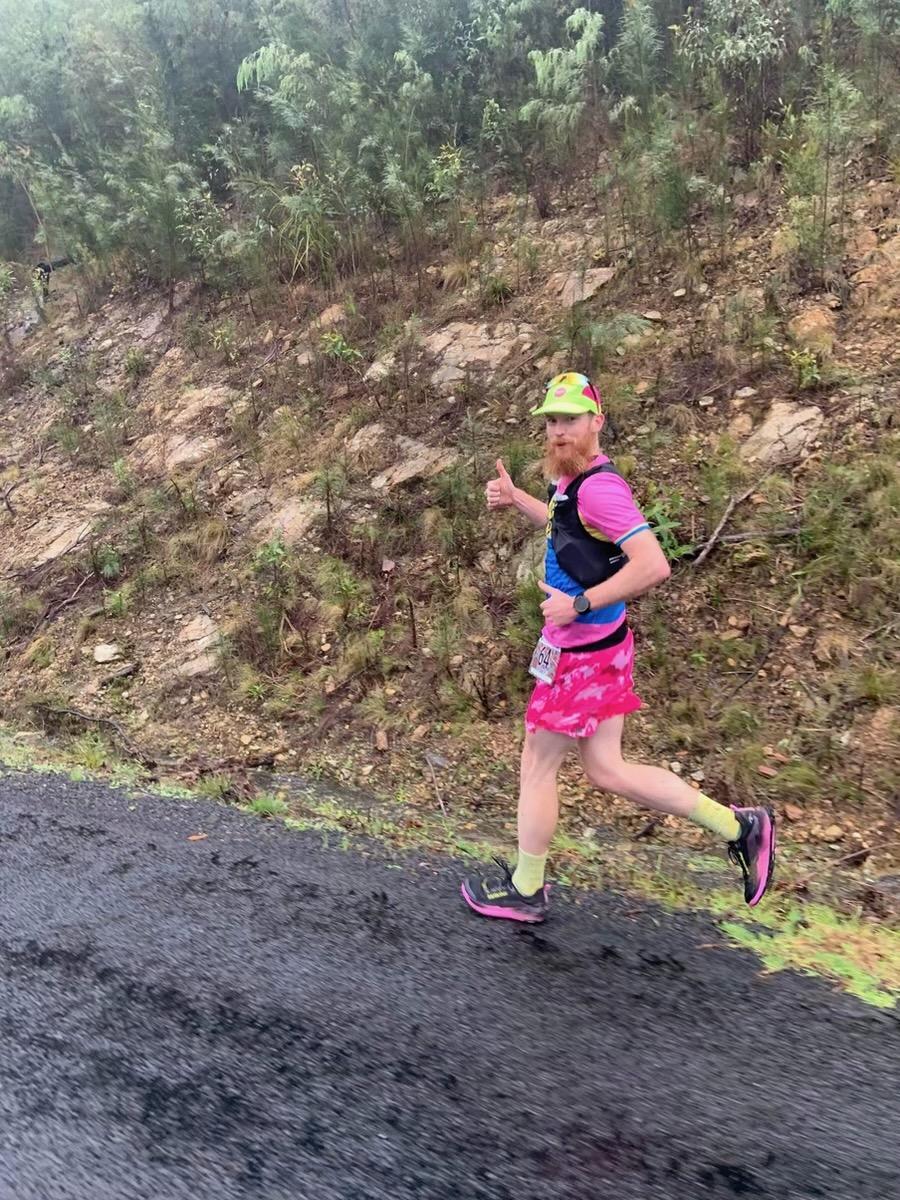
Heading up Cow Bail Trail.
Whatever the reason, I had to make several stops into the bushes, but none of it really providing the relief I was looking for. At one point I stood up from the bushes and someone yelled "hey it's pink-shorts!" from a group of runners passing.
Excellent timing to be caught, literally, with my pants down.
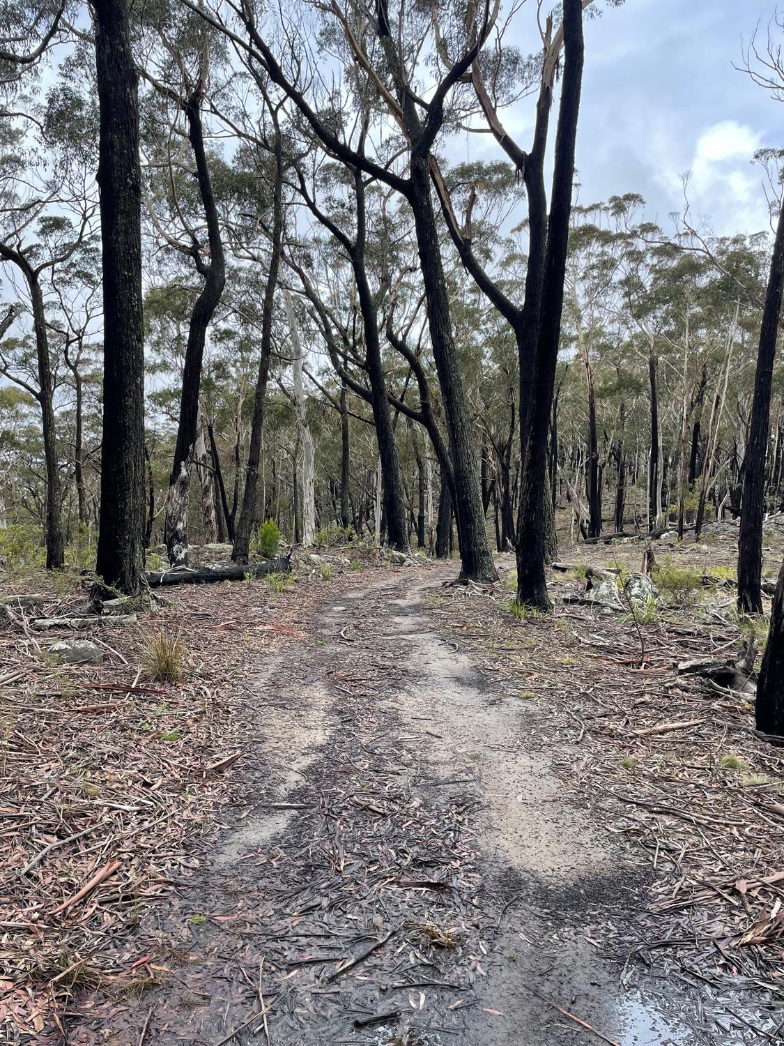
Reaching the top of Cow Bail Trail is a pretty good feeling. At some stages during the climb you get some views looking down across big Jack Mountain Road which gives you an idea of how much higher this little detour is. It opens out into a runnable pine forest and from there it's pretty easy going into Cathcart.
We did have an additional river crossing though, where Mickey somehow appeared once again out of nowhere to give us a hand crossing, all while the Forestry staff were trying to close the road.
Possibly a little sketchy, but we got across.
In typical fashion, it began to rain again coming into Cathcart. I'd already decided that my original plan had gone out the window and we were going to take it stop-by-stop to ensure my stomach had settled. Running into Cathcart in the pouring rain I had a welcome sit-down, a rice pudding and some ginger beer.
Leaving Cathcart I once again ducked into the public toilet there - it was to be the last toilet for about 80km - and thankfully that seemed to be the last of it. Unfortunately, I never really got my nutrition back on track which is definitely something to learn for future events.
From Cathcart I was looking forward to the cruise through the relatively flatter countryside, and happier now that I'd resolved some stomach issues and was on the way to Dalgety. This section was a lot of gravel road, a few flooded crossings, and rolling, gradual inclines. It felt like the field hadn't really spread out too much, so we were seeing many of the same crews around which made for quite a fun atmosphere.
I felt like I got a bit of fairly consistent running along here. Every 5km my crew were meeting me with a bottle of just fresh water, and feeding me foods that seemed to be going in. Whilst my nutrition wasn't on-track, at least I was getting a drip-feed of calories in.
It's a deliciously flat 12km section from Cathcart to where we cross the Monaro Highway at Bibbenluke.
After the highway crossing, it gets a little hillier but still comparatively flat to the first section. There are a bunch of cattle grids to cross without breaking any ankles, and it's scenic farmland with sheep and cows wandering around the unfenced road.
I ticked off another milestone on this leg - a 100km PB time of just under 11:35. Not bad, not bad.
Unfortunately, it's just past the 100km mark and with only a few kilometres to go until Checkpoint 4, that things got a little more stressful. I was feeling good leaving my crew with a couple kilometres to go until the checkpoint, when from behind me instead of the usual sound of the car starting it instead emitted a horrendous grinding sound.
I stopped, waiting, and it happened again. Not good. I thought about waiting to see what happened, but I thought I should keep rolling to the checkpoint, given how close it was, so I kept running just as my crew were flagging down another vehicle.
They drove past a few moments later - the starter motor in the car had failed, but they had been able to roll-start it. Despite being told not to worry about it by my crew, my mind was still racing. Could we at least get to Dalgety, swap crew vehicles with Mike? I let the crew know that they should do whatever they need to do, and it's not worth damaging the car further over.
What I was really trying to get across was that if I needed to withdraw due to an issue with the support vehicle, then so be it - I wasn't going to be upset at the crew about it.
Whichever way it was going to go, they fed me yet more pudding at Checkpoint 4 and I got changed into a long-sleeve shirt for the night section, and donned my high-vis vest as required by the race rules. Then, hit the bitumen (it was now all bitumen until Charlotte Pass!) and started moving towards Dalgety.
In further evidence that my mental game was not as strong as it has been in the past, for some reason I had it in my head that the CP3 - CP4 leg was the longest leg, but in reality it's the CP4 - Dalgety leg. A minor issue, really, but I think it was just another thing that I had to compensate for mentally.
Overall the next leg wasn't too bad. Things descended into darkness and my crew made the call to give me my head torch at the perfect time. A few more kilometres down the road and Rachel decided to join me to pace for a little while, making sure I'd get some gels in. This was a nice little change to have someone to run with for a while.
After about 15km, Rachel jumped back in the car and I carried on solo, knowing that it was less than 20km to Dalgety. At Dalgety I'd pick up Mike for another stint of pacing.
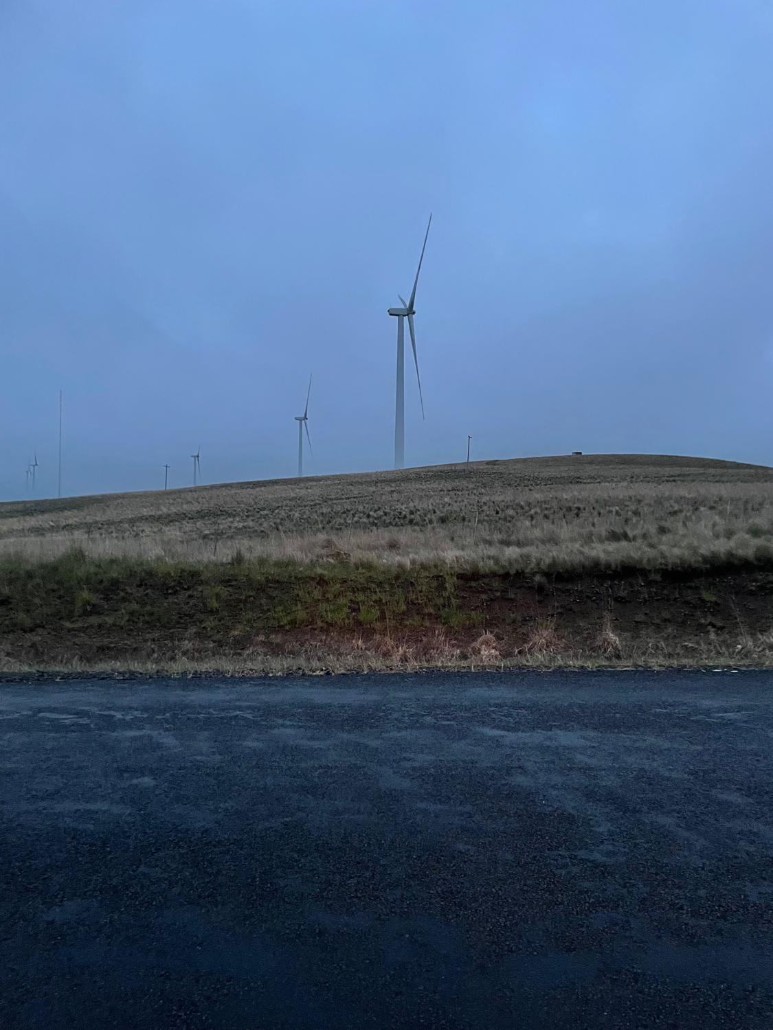
The run into Dalgety isn't too bad and it's reasonably flat, except for one real annoying hill up to the wind turbines that just feels like it goes on forever, but after that you can cruise down the other side and get some good running in. Seeing the race officials cruise up and down was always uplifting, and after what felt like quite a while I made it into the town of Dalgety - this was a good milestone.
I stopped into the nice, warm Dalgety hall... Truly a dangerous place, and it would be so easy to get stuck here for too long. It's the middle of the night, you're tired, you're hungry, and the hall is warm, inviting and has hot food (not to mention a good toilet!)
I needed to be sure I got in and out reasonably quickly. My crew gave me some noodles to chew on and I changed my shoes into road shoes (up until now I'd been wearing trail shoes). All up I spent a bit over 10 minutes in the Dalgety Hall, which probably isn't too bad.
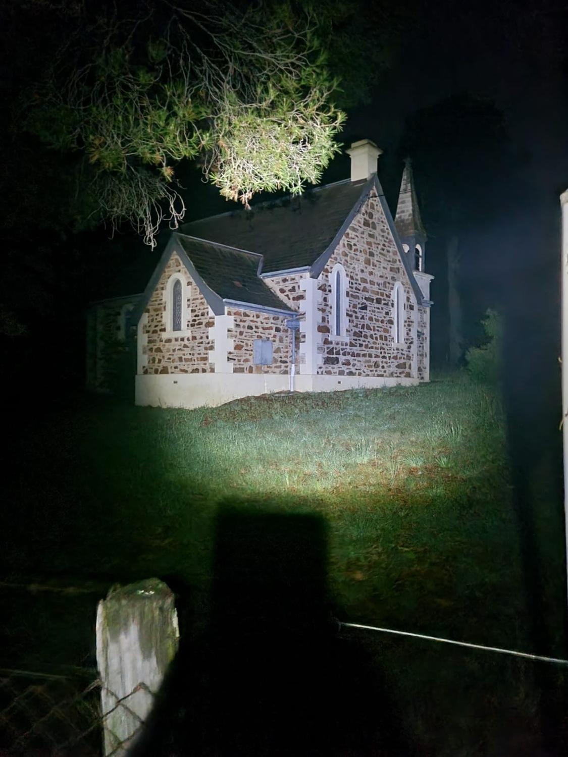
With a groan I levered myself out of the chair, and left the hall with Mike by my side ready to pace for the next 90-odd kilometres. We started off at a walk across the Dalgety bridge and then up the slight incline, starting the journey to Jindabyne. This next leg isn't too bad. There's a bit of an incline out of Dalgety, which is probably runnable if you have the legs but I was walking at this stage trying to get my noodles to settle, though we did run the downhill parts with a stop to take photos of the church out there - I'm sure is a lovely church, but it is kindof creepy when you're passing it on foot at 1AM.
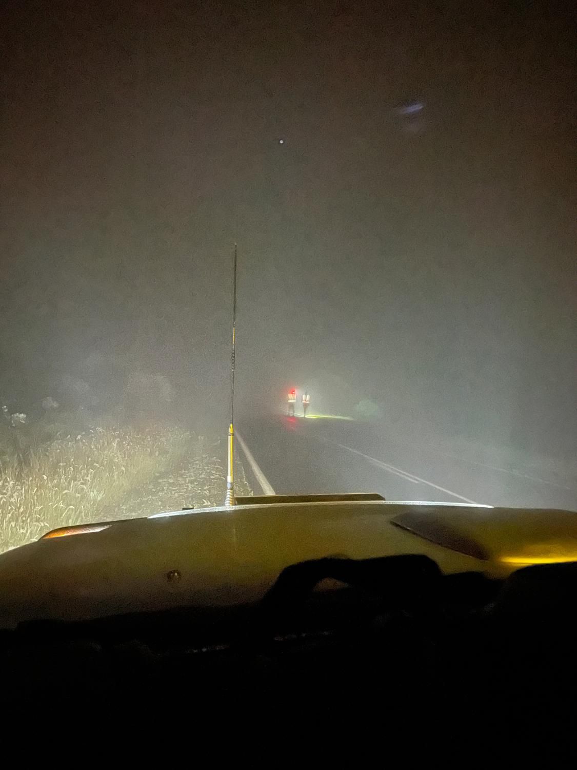
We could see lights in the distance of runners ahead going up Beloka Hill giving a good impression of the height of the hill, and after some time arrived at Beloka Hill ourselves. It really is obvious when you arrive at the hill, because it's just a wall in front of you extending up into the darkness and fog.
Starting the climb, it also started to rain a little bit more (as is tradition) and we trudged up into the rain and fog, making slow progress and commenting on how there's probably a great view out there behind all that rain and cloud.
The climb went on, and just when we thought it was done, the climb would throw some more at us.
After what felt like an eternity, but was actually only about 40minutes, we could see a yellow flashing light through the fog - we had reached the top. All I wanted to do was sit down and close my eyes, but I looked at the time and knew that these feelings are completely normal for 3AM, and that in another hour or two I would start to feel better.
Another milestone was ticked off around here, however - a new personal best time for a 100 mile distance, of a little under 20 hours!
Somewhere at the top of the climb we passed another runner, who was talking about withdrawing, and not long past we saw his crew car go past.
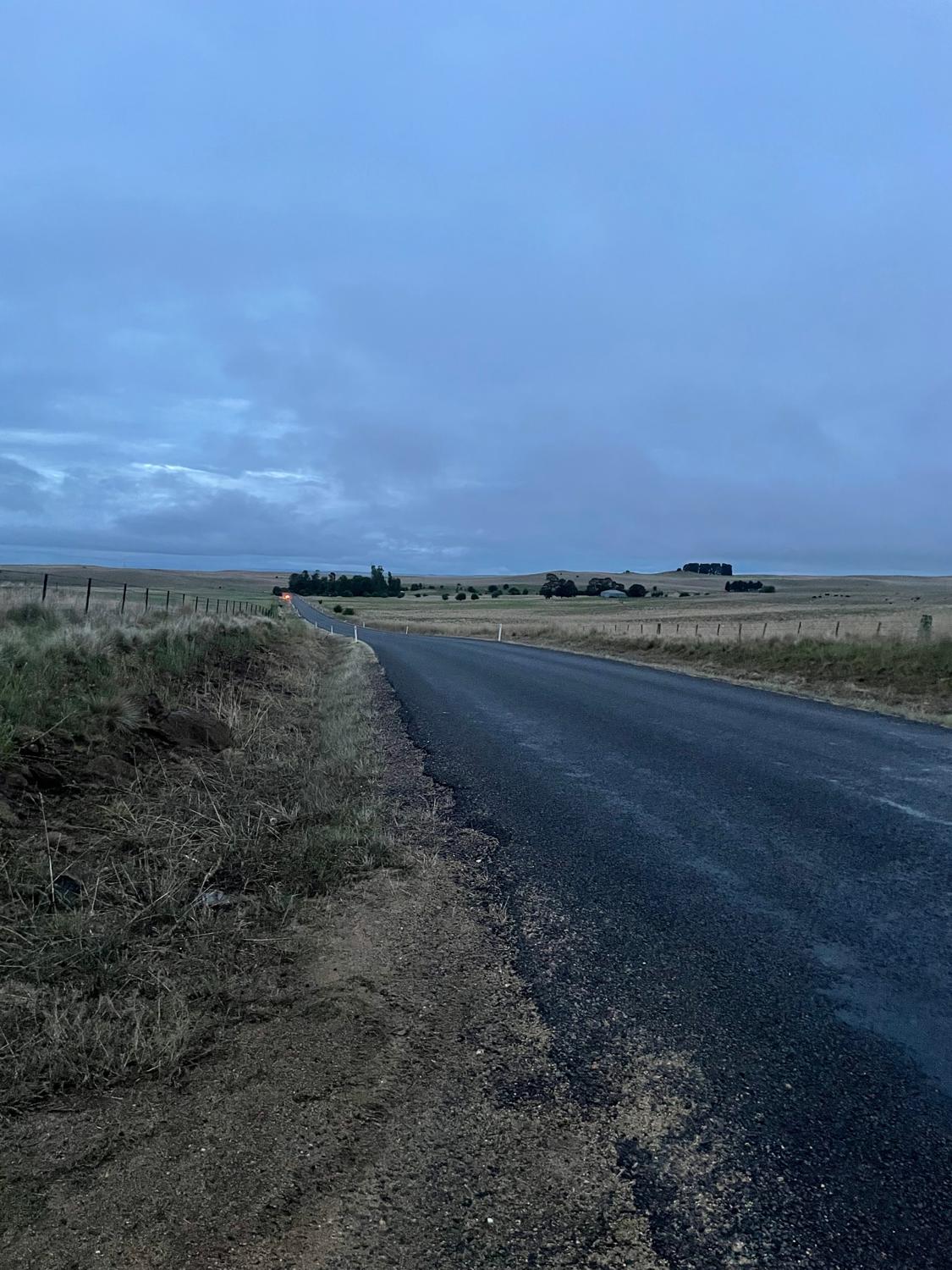
From here to Jindabyne it's honestly a bit of a blur - I think we got some good running in on the downhill and flatter sections, checking out some of the hectic fences along the way, and had a car full of blokes (unrelated to the race) cheer us on at about 4am - Where they came from or where they were going is still a complete mystery to me.
As we approached the intersection of The Snowy River Way and Barry Way, the sky was starting to lighten, and it was only a couple more slight hills on the way into Jindabyne and then a descent toward the lake. Some marshals gave us a hand with crossing the road and instructing where to go, and before we knew it we were on our way to the caravan park. Entering the caravan park we passed a tent with some hectic snoring coming out of it - I'm glad our slow shuffling didn't wake the person up!
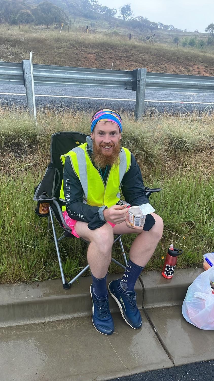
It was getting light now, so my head torch came off and I had some warm oats and a little more ginger beer for breakfast. Some words here were uttered about chafing in particular locations, and I had to put some more anti-chafe in some locations that probably shouldn't be repeated. But given we're 180km of sogginess into the day, and maybe that's not so bad.
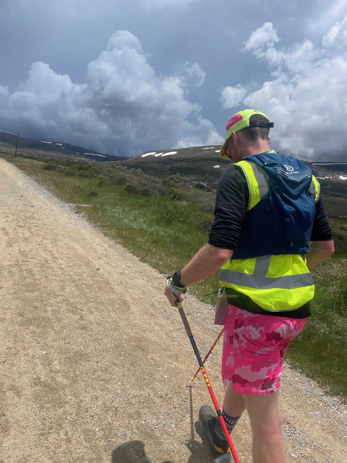
We left Jindabyne with a pretty slow, ginger walk and started the way towards the climb that was coming up, but managed to get a bit of running in particularly on the downhill down to the Thredbo River. Just after crossing the river, I decided to bust out the poles and start hiking. I knew this was going to be a tough, slow slog, but I ended up feeling worse than I expected and even had to sit down for a moment at the surge tower - this wasn't good, and a sign that my nutrition was even further behind than I thought it was and we really needed to address the issue.
At the next stop we made the decision to sit down for a moment and try to get some food in to try to resurrect things a little bit. I managed a cheese roll and most of a rice pudding, before getting up and carrying on, feeling a little bit better. Overall, despite sitting down for 5 or 10 minutes this was a good decision given how much under my nutrition I was.
Although I had been getting some nutrition in, it clearly wasn't enough and nowhere near what I had been planning. Given I was nearly 200km in, I'm not surprised that a lack of nutrition was catching up with me.
Somewhere around here I was passed by both Simone Hayes and Jalna Clair - how they can hike so fast up the hill I will never know, but power to them!
We carried on, stop-by-stop and crested the hill at Guthega Road, getting another run in on the downhill to Sponars Chalet, and then up and over Dainers Gap getting more of a run in on the downhill, before rolling into Perisher.
Upon arriving at Perisher I was feeling relieved for my crew knowing that there was only one more stop for them before Charlotte Pass!
It's only about 8km between Perisher and Charlotte Pass, much of it is reasonably flat, so we hiked the first little section and then got some shuffling happening on the downhill sections. The plan was to meet the crew at halfway but it ended up being a little more than that before they could find somewhere to stop - this was good though, because it meant less distance to go to the next checkpoint!
We ran the last little bit and then climbed up to Charlotte Pass! I couldn't decide if I was feeling hot or cold at the moment - burning up in the sun but then feeling a little chilly when we were back in the wind. My amazing crew had already sorted out all the gear for the summit path, so I changed shoes (bad idea given the swelling in my foot), and then we got going.
We left Charlotte Pass for the summit in brilliant weather (I was even feeling a little hot), however not far into the trek I passed a couple other guys and their pacers and just as we were doing so the clouds near the mountains let rip a massive thunderclap.
One of the other nearby pacers immediately and appropriately said "now that can fuck right off".
We carried on for a bit then donned rain jackets (I sat on a rock to do so) just before the rain hit. The storm hit, and we endured freezing winds, rain and hail and pushed up to shelter at Seamans Hut.
We squished into Seaman's Hut along with a whole bunch of other people, but after stopping so suddenly I began to feel quite faint. Conveniently there was also a hiking group of nurses sheltering in the hut who made sure I had somewhere to sit and got sugar into me which was really nice of them, and made me feel a bit better.
When the weather broke up a bit, we left the hut and were on the cusp of starting a push to the summit but a pacer came running after us to tell us that an inclement weather finish had been called and anyone on the mountain was to shelter in place until the weather cleared enough to descend. I didn't get his name, but I'm really grateful that this guy came after us!
So, we started to make our way back down. I was absolutely freezing by this point, but with a break in the weather we decided it was best to get off the mountain as quickly as possible and get ourselves warmed up. I was originally planning to try to get a shuffle in on the descent but we ended up just walking the whole way back down, though at a pretty solid pace.
I was counting down the distance markers back to Charlotte Pass, and now that the rain had eased and we were somewhat out of the wind I wasn't feeling like I was in quite a dire situation. We re-entered the treeline, and I managed a slight jog and even a small jump coming into the finish line.
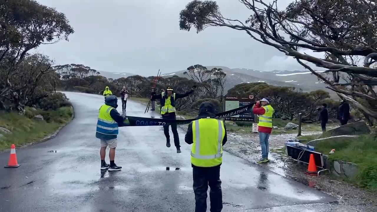
What an experience! Not your normal Coast to Kosci experience in any sense (so I'm led to believe) but I had done it! With an inclement weather finish, the finishing time is taken from my time at Checkpoint 8, so really I just did an extra 12km for fun...
After finishing I was pretty much bundled into the car under a bunch of blankets to head down the mountain into Jindabyne. It was going to take a little while for me to feel normal - the beer at the pub that night felt like it had bones in it!
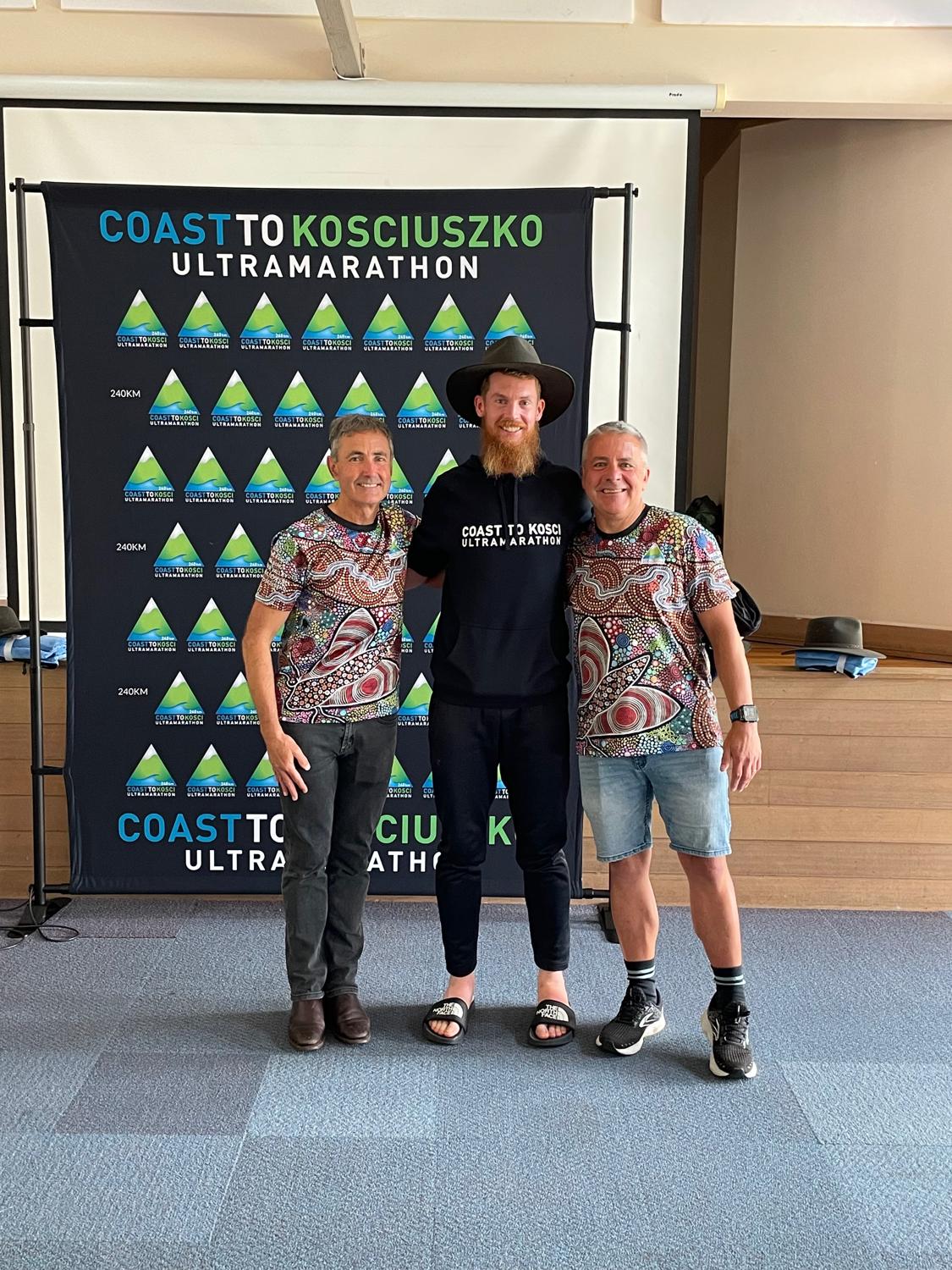
I did manage to get over for breakfast and presentations the next morning though! It was a real honour to receive my Akubra and first hat pin.
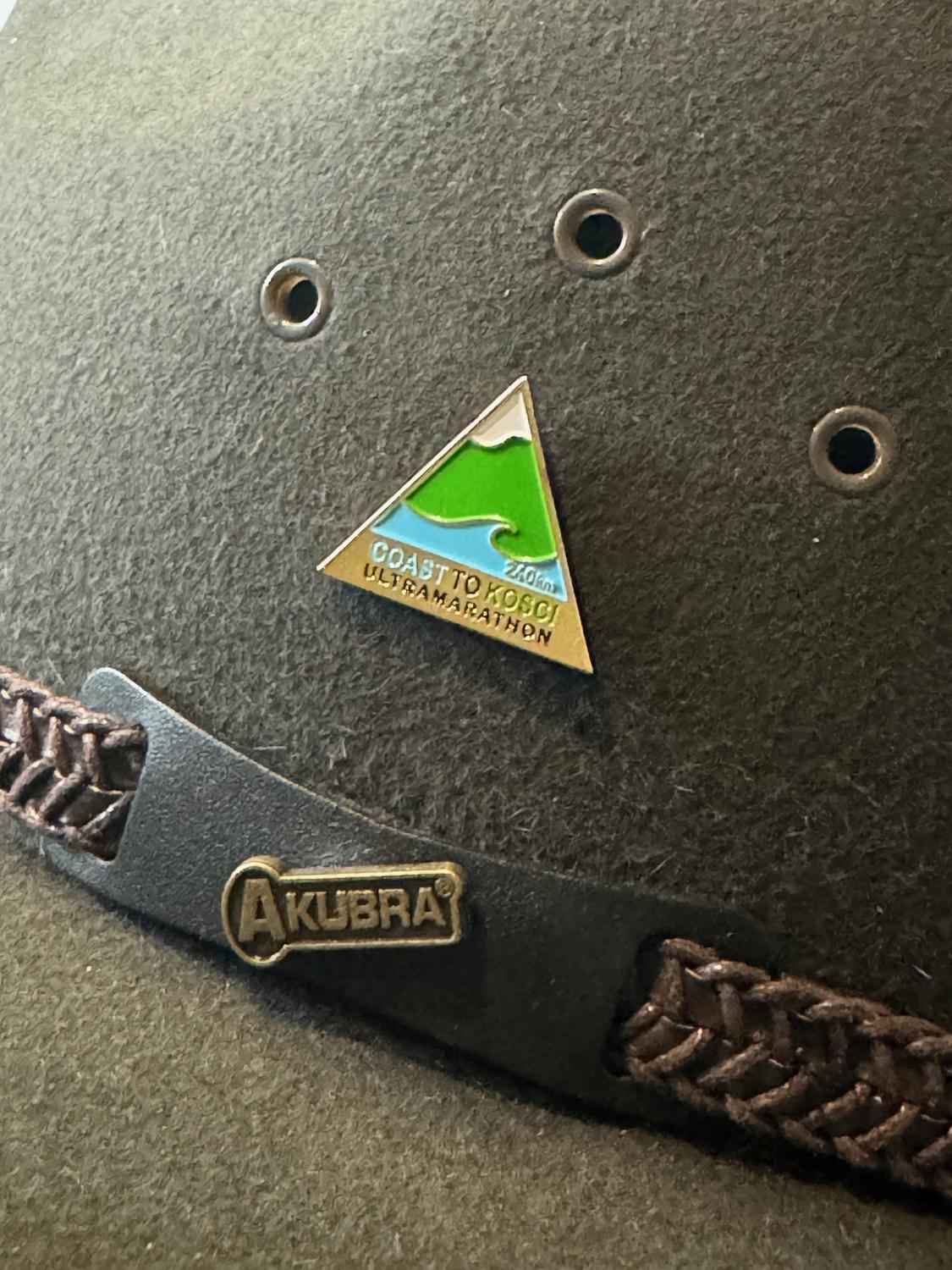
The coveted Akubra and hat pin.
I learned a hell of a lot of lessons on this. I thought I was going in respecting the course and the event but it still handed it to me and truly humbled me. Amongst the nutrition issues (which is something to nail down and sort out, despite it going well in training) this is probably the first time in a long ultra where my mental game has been off, and that definitely made it difficult for me to handle internally despite being totally normal feelings.
As for what's next - Other than the Six Foot Marathon I haven't decided what's on the race / adventure calendar for 2024. If you had asked me halfway up the hill to Perisher if I would do Coast to Kosci again I probably wouldn't have said yes.
Now? One pin on the hat does look a little bit lonely...